March 27, 2023
Pilot project uses satellite to track carbon dioxide emissions from 100 countries
First-of-its-kind study a contribution to global stocktake of greenhouse gas emissions
An international study by more than 60 researchers, including five from the University of Wollongong (UOW), has used a NASA satellite to track carbon dioxide emissions for more than 100 countries around the world.
The pilot project used measurements made by NASA’s Orbiting Carbon Observatory-2 (OCO-2) mission, as well as a network of surface-based observations, to estimate carbon dioxide concentrations in the atmosphere from 2015 to 2020. The researchers were then able to infer how much carbon dioxide was emitted and removed from Earth’s surface through natural processes.
The findings come at an opportune time as countries around the world take part in a stocktake of greenhouse gas emissions – a process to assess the world’s collective progress toward limiting global warming, as specified in the 2015 Paris Agreement. The pilot project is a contribution to the first Global Stocktake, which began in 2021 at COP26 in Glasgow, Scotland, and will conclude in 2023 at COP28 in Dubai, United Arab Emirates.
Distinguished Professor Noel Cressie, Associate Professor Andrew Zammit-Mangion, and Dr Michael Bertolacci from the UOW’s School of Mathematics and Applied Statistics, and Associate Professor Nicholas Deutscher and Emeritus Professor David Griffith from the School of Earth, Atmospheric and Life Sciences, were co-authors of the study.
Launched in 2014, the OCO-2 satellite maps natural and human-induced carbon dioxide concentrations with the help of three camera-like spectrometers. These devices are tuned to detect the unique spectra, or light signature, of carbon dioxide. They measure the gas indirectly by how much reflected sunlight it absorbs in a given column of air. Associate Professor Deutscher is the Asia/Oceania lead for an international team including Professor Griffith involved in validating these measurements.
Associate Professor Zammit-Mangion, Dr Bertolacci, and Professor Cressie were core members of a team that developed a Bayesian statistical framework named WOMBAT (Wollongong Methodology for Bayesian Assimilation of Trace-gases) at the University’s Centre for Environmental Informatics. WOMBAT is able to separate the signal from noise in data from the OCO-2 satellite and provide an accurate picture of where CO2 was emitted and absorbed across Earth’s surface over time. This is described in more detail elsewhere.
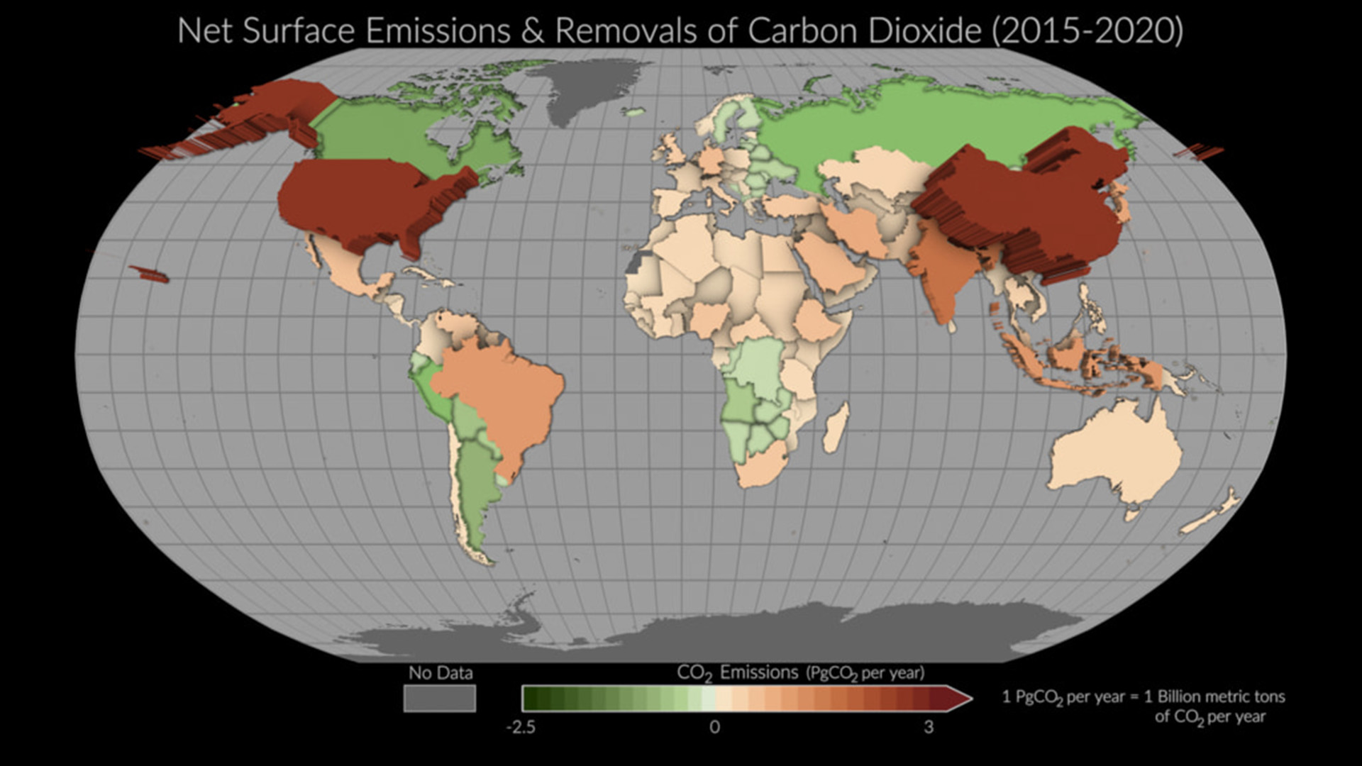
This visualization shows yearly net surface emissions and removals by more than 100 countries from 2015 to 2020. . Countries with emissions, seen here in red, appear to pop from the page, compared to countries with removals, seen in green.
Associate Professor Zammit-Mangion said that the study is the first of its kind in scope and scale, and offers a unique view of the carbon cycle from satellite and surface measurements.
In addition to direct human impacts accounted for by national inventories, unmanaged ecosystems such as tropical and boreal forests – where humans have a minimal footprint – can sequester carbon from the atmosphere, thus reducing potential global warming.
Professor Cressie, Director of the Centre for Environmental Informatics, said: “National inventories are intended to track how management policies impact emissions and removals of CO2.”
“Because of atmospheric transport through the planet’s weather systems, CO2 being emitted from either deforestation in the Amazon or wildfires in the Canadian Arctic increases the overall concentration of atmospheric CO2 and drive climate change. Therefore, it is critical to monitor the carbon balance of unmanaged ecosystems and identify any changes in carbon uptake.”
Acting Deputy Vice-Chancellor (Research and Sustainable Futures) Professor Theo Farrell said the UOW research team and their colleagues were making a valuable contribution to efforts to address climate change.
“This project aims to help governments around the world to measure the impacts of their carbon mitigation efforts and to assess our collective progress toward limiting global warming. It will also inform future efforts to reduce emissions and to remove greater amounts of carbon dioxide from the atmosphere,” Professor Farrell said.
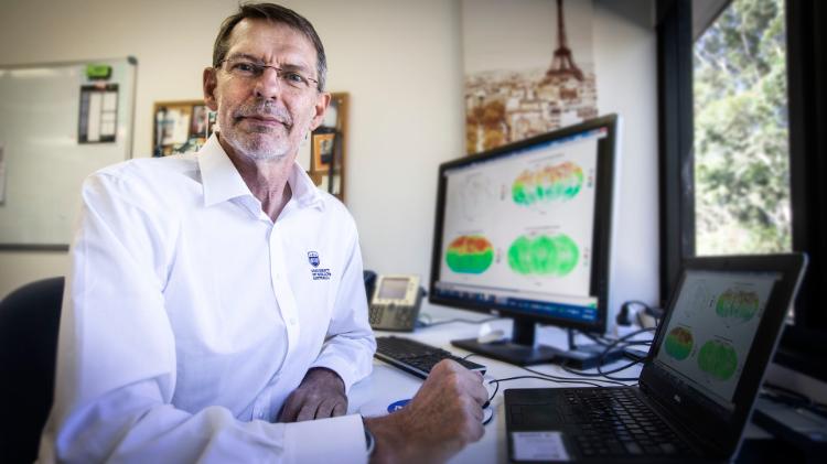
Professor Cressie, Director of the University of Wollongong's Centre for Environmental Informatics, said it is critical to monitor the carbon balance of unmanaged ecosystems and identify any changes in carbon uptake. Picture: Paul Jones, UOW
The study’s “top-down” approach offers a powerful new way to measure carbon dioxide being emitted by countries and how much of it is removed from the atmosphere by forests and other carbon-absorbing sinks within those countries.
Traditional activity-based (or “bottom-up”) approaches to carbon measurement rely on tallying and estimating how much carbon dioxide is being emitted across all sectors of an economy, such as transportation and agriculture.
Bottom-up carbon inventories are critical for assessing progress toward emission-reduction efforts, but compiling them requires considerable resources, expertise, and knowledge of the extent of the relevant activities.
Looking forward, the researchers said their pilot project can be further refined to understand how emissions from individual nations are changing.
Lead author Brendan Byrne, a scientist at NASA’s Jet Propulsion Laboratory in Southern California, said: “Sustained, high-quality observations are critical for these top-down estimates. Continued observations from OCO-2 and surface sites will allow us to track how these emissions and removals change as the Paris Agreement is implemented. Future international missions that provide expanded mapping of CO2 concentrations across the globe will allow us to refine these top-down estimates and give more precise estimates of countries’ emissions and removals.”
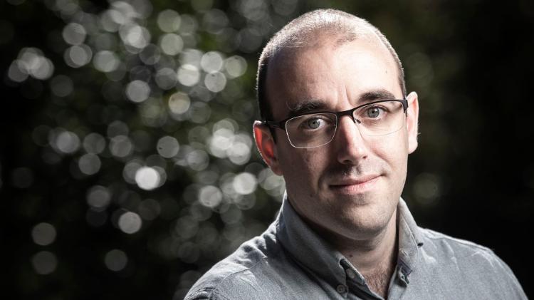
Associate Professor Zammit-Mangion said the study is the first of its kind in scope and scale, and offers a unique view of the carbon cycle from satellite and surface measurements. Picture: Paul Jones, UOW
ABOUT THE RESEARCH
‘National CO2 budgets (2015–2020) inferred from atmospheric CO2 observations in support of the global stocktake’ by Brendan Byrne et al. was published in Earth System Science Data. (https://doi.org/10.5194/essd-15-963-2023)
The research of Noel Cressie, Andrew Zammit-Mangion, and Michael Bertolacci was supported by an Australian Research Council Discovery Project and by a NASA ROSES project. Andrew Zammit-Mangion was also supported by an Australian Research Council Discovery Early Career Research Award. Nicholas M. Deutscher was funded by an ARC Future Fellowship.
Main image: Mean net surface emissions and removals of carbon dioxide (CO₂) for over 100 countries around the world for the period 2015-2020.