October 20, 2015
The 'eyes and ears' keeping a watch on landslides
Real-time monitoring of sensitive landslide areas is helping to keep road and rail users safe.
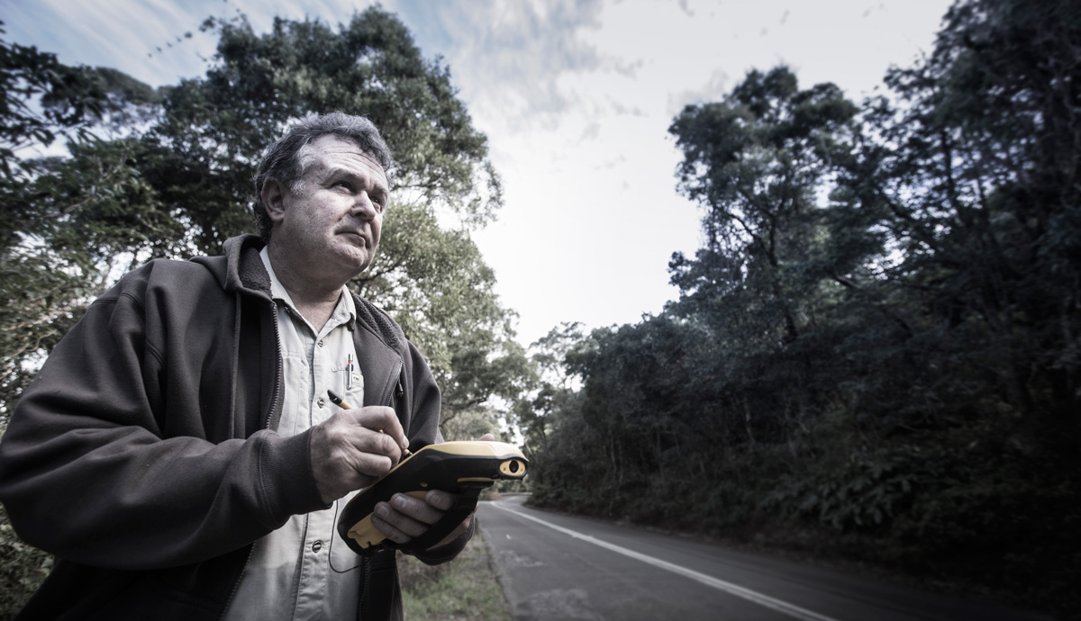
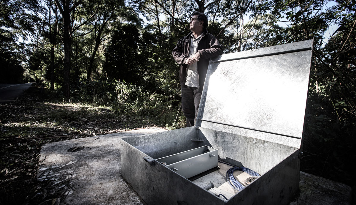
“There's often a few little presents inside this box,” geologist Dr Flentje says as he opens what would appear to most passers by as a nondescript metal box on the side of Mount Keira Road.
Fortunately, no insects, spiders, snakes or other animals have made the warm and dry confines of the box home this time. The box houses an assortment of electronics including a wireless signal unit and instruments that are connected to a steel cable that descends into the earth via a small plastic pipe.
The nondescript box is the ‘eyes and ears’ of landslide activity on Mount Keira and it’s one of 30 similar stations across the Illawarra and Sydney Basin area.
Over the past two decades Dr Phil Flentje, a Senior Research Fellow from the Faculty of Engineering and Information Sciences (EIS), has been mapping and monitoring almost 2000 active landslide sites within the Sydney Basin, 645 of these within the northern Illawarra and many of which support infrastructure that carries thousands of cars and rail passengers and freight each day.
The 'eyes and ears' of the earth
"We hit bedrock at a depth of four metres,” Dr Flentje explains, “everything above that is what we call colluvium: soil and rock deposited by landslides.”
He points out various rocks, some larger than a car, strewn through the bush and explains they are “recent” landslides, only a few thousand years old. The entire ground surface in this area is underlain by colluvium, and over time it is all marching slowly, inexorably, downslope under the influence of gravity.”
Other instruments are measuring temperature, rainfall, wind and underground water pressure but the key element is the 21-metre long steel cable.
It detects even the slightest movement in soil. Data is captured every hour from each monitoring site and logged on a server at UOW.
This system enables Dr Flentje and his industry colleagues access to near real-time data via his iPad, or any web browser, as well as receiving alerts if excess movement is recorded.
“The ground is often moving in minute amounts, but periodically there are thresholds or triggers that make us pay particular attention to the data from the monitoring sites. For example, a couple hundred millimetres of rain in a 24-hour period would be a concern. We have certain thresholds for 30, 60 and 90 day periods as well.”
Necessity the mother of invention
The monitoring system -- custom built for local conditions and needs - was not always in place as a first line of defence. As often is the case, necessity is the mother of invention. The necessity arose when more than 750 millimetres of rain fell on the Illawarra in a four and a half day period in mid to late August 1998.
“During the afternoon and evening of the 17th of August there were 142 landslides across the region and an emergency event was declared for the City of Wollongong,” Dr Flentje says. “The main transport arteries were cut, the airport was flooded and Wollongong was completely isolated for a day.
“Out of that event Wollongong City further developed their emergency planning and we set about establishing a number of live monitoring stations where we could monitor these landslides, and to a degree, remotely.”
Work began shortly after the setting up the monitoring stations. The process has involved thousands of hours of walking to each landslide site and recording data about the size and type of the landslides that develop to add to a digital map of known landslide locations that continues to evolve with every downpour.
“My role in support of my industry partners Wollongong City Council Roads and Maritime Services and formerly Sydney Trains is to provide advice on these landslides and monitor for their assets that traverse these sites.
“While the objective is to actually get in and remediate these challenging features, costs are always an issue. Monitoring provides an interim option until the remedial works proceed, and often ongoing maintenance after works are completed is undertaken to confirm and or assess the remediated sites performance.”
Understanding shaky ground
While most people would be familiar with the idea of landslides as soil and rock careening down steep hillside, Dr Flentje explains there are a range of landslide types that cause engineers headaches when designing key infrastructure.
“The catastrophic landslide image is often the first to mind, the reality is typically more subtle and often difficult to interpret. The damage is still there and very expensive to repair,” Dr Flentje says. “The three main types are rock falls, debris flows and earth slides. These are three entirely different types of landslides but they’re all landslides.
"Two of those categories, the debris flows and the earth slides, are both associated with water.”
Large amounts of rainfall put more water into the ground and it’s that rise in groundwater pressure that causes the majority of our landslides to occur.
Landslides are typically naturally occurring phenomena and the data Dr Flentje and his industry partners gather is helping to protect the infrastructure and the community. With 300,00 people living in the wider Illawarra area next to the escarpment, land needs to be managed and planned with respect of this natural instability.
"It’s critical that we manage landslides as best we can. Our digital landslide maps are used to help develop landslide susceptibility maps to help local government manage ongoing developments.
“The key issues are our population growth and growing urbanised areas, as well as transportation routes such as the South Coast rail line and Mount Ousley Road. These are carrying more and heavier transport on older infrastructure, which we need to constantly manage.”
“We can’t predict landslides yet, but we can alert in near real-time that thresholds have been reached, and based on the monitored performance, we can forecast when alarm levels will be reached. It’s vital as a way of increasing our awareness and helping the asset managers to be able to keep the community as safe as we possibly can.”