The Digital Living Lab is home to game changing projects addressing key social, economic and environmental challenges facing our region in an effort to become a truly smart city.
Projects
- Air Quality Monitors
- Building Energy Monitoring
- Greenhouse Gas Emissions in Estuaries
- Liverpool Smart Pedestrian
- Morse Micro
- Navability App
- 3D Printed Fins for Surfboards
- SharkEye
- Smart Digital Twin Building
- Smart and Safe Campus
- Smart Hydrants
- Smarter Schools
- Smart Waterways
Brief
Low-cost Air Quality Monitors are being used by the Centre for Environmental Risk Management of Bushfire at the University of Wollongong to measure and map the fine-scale distribution of smoke pollution from prescribed burns in the Sydney region.
This will enable an exploration of the reasons why some prescribed burns cause large smoke events.
The Centre for Environmental Risk Management of Bushfire are working closely with the Office of Environment and Heritage and Rural Fire Service to inform their fire management to minimise smoke impact while still protecting life and property from bushfires.
Project Contacts
Project Sponsors
Brief
The Building Energy Monitoring Project will develop a wireless sensor network to monitor the environmental conditions within a building such as temperature and occupancy, as well as develop a web-based platform for building control and analytics.
The multi-protocol building sensor system will incorporate algorithms that detect occupancy through image recognition; that forecasts room temperatures through analysis of historical temperature, outdoor temperature, solar radiation and HVAC power delivered; and a vibration sensor prototype that detects early abnormalities in moving parts such as fan motors.
The team is lead by Dr Rohan Wickramasuriya. Funding partners are Grosvenor Engineering Group, Enviro Building Services and the NSW Government (through the Department of Industry).
Project Contacts
Rohan Wickramasuriya - SMART Senior Research Fellow
Benoit Passot - SMART IoT Initiatives Coordinator
Lei Wang Associate Professor - School of Computing & Information Technology (SCIT)
Massimo Fiorentini Research Fellow - Sustainable Buildings Research Centre (SBRC)
Johan Barthelemy Research Fellow - SMART Infrastructure Facility
Mehrdad Amirghasemi, Associate Fellow - SMART Infrastructure Facility
Federico Tartarini Research Fellow - Sustainable Buildings Research Centre (SBRC)
Pouya Ghadimi Optimisation Engineer - Grovesnor engineering group
Christopher Andronikos Building Optimisation Engineer - Grovesnor engineering group
Aidan Pickard - Enviro services
Matthew Cochrane - Enviro services
Grant Campbell Project Coordinator - SMART Infrastructure Facility
Project Sponsors

Brief
The greenhouse gas emissions in estuaries project aims to measure greenhouse gas emissions from carbon sinks, such as mangrove swamps at Minnamurra in the Illawarra. The project will use several sensors connected to the LoRaWAN network to deliver data to quantify the ecosystem service of carbon sequestration provided by the mangroves.
The challenge – met by the Digital Living Lab – is to develop affordable sensors that record and transmit CO2 and CH4 gases both spatially and temporally.
The collected data will provide important information about environments that are under threat from land-use conversion and enable the identification of areas where carbon storage is high and emissions back into the atmosphere are low.
Brief
The Liverpool Smart Pedestrian project is a research collaboration between SMART, Liverpool City Council and Industry partners.
The project will improve the efficiency and effectiveness of, and access to a range of state and local government services & facilities by significantly adding value to the new Liverpool Civic Place project at the southern end of Liverpool’s CBD.
Previously, Liverpool City Council did not have data on existing pedestrian movements or behaviour as the baseline to design the future management of movement. This project seeks to take the smart city initiative to a new level of technology by monitoring pedestrian and vehicle movement without any compromise to the privacy of the people of Liverpool.
SMART researchers have developed a solution using machine learning to count people and cars at key locations using IoT technologies with this ground-breaking initiative revolutionising urban design and traffic management for the city. This first of its kind, innovative, smart technology and open data for real time measurement of pedestrian behaviour movements, which will guide smart planning for the pedestrian movements, the active and public transport options and the safety of students, workers and other pedestrians.
Patterns of movements and points of congestion will be identified before they occur and solutions, such as through the design of improved street and footpath layout connectivity, traffic management and guided pathways.
Project Contacts
Project Sponsors


Brief
One of the great selling points of the Digital Living Lab is sensors that are cheap, powerful and take very little battery power.
Morse Micro is a semiconductor company that is developing Wi-Fi HaLow chips for the Internet of Things. Morse chips are five times smaller and cheaper, have ten times the range and use two hundred times less power than conventional Wi-Fi chips.
They offer a range of a kilometre, have power so low that a single coin cell battery can power a device for many years, and offer secure communication from the start.
Every Morse device gets an IP address to connect directly to the internet. No hubs, bridges or phone apps are required.
The company was founded by Andrew Terry and Michael De Nil, both veteran designers, who led the development of the Wi-Fi chips found in virtually all iPhone and Galaxy phones on the planet.
The company has teamed up with the Digital Living Lab as an obvious collaboration of benefit to both parties.
Morse Micro can take advantage of the research and projects provided by the Digital Living Lab, while sensors used by the projects can use the superior technology offered by the company.
Project Link
Project Contacts
Andrew Terry - Morse Micro Co-Founder & RF IC Design Engineer
Michael De Nil - Morse Micro Co-Founder & Digital IC Design Engineer
Benoit Passot - SMART IoT Initiatives Coordinator
Project Sponsors

Brief
Brief
Surfers can order surfboards that are customised to their needs, or choose from a range of pre-made boards, with little difference in cost. When it comes to surfboard fins, however, it’s a different story.
Fins are aerodynamic foils that act like rudders while surfing, usually attached to the rear bottom of the surfboard. Fins were once permanently glassed into the board, but these days almost all boards have a removable fin system.
Manufacturers of removable fin systems make exceptional products, but the current manufacturing process involves injection moulding, which is very expensive. This pushes it out of economic reach for most surfers looking for a customised fin.
Enter 3D printing. This project addresses the Global Challenge of Manufacturing Innovation. Professor Marc in het Panhuis and his team of scientists and surfers have developed, designed and 3D printedsurfboard fins made from composite materials, and have built and trialled prototype fins with flexibility similar to those available in shops.
The problem is the sheer volume of data that quickly accumulates. Typically, each surfer generates five spread-sheets plus a unique data file for each wave surfed during a session. A single surfer can easily ride up to 30 waves in an hour.
The team is now working with the Digital Living Lab to upload the data through the cellular network and develop software that will process the raw data and deliver the analysis for the perfect fins to suits the beach, the surf conditions and the surfer.
Project Link
Project Contacts
Professor Marc in het Panhuis - UOW, Project leader, Materials and Surfing Trials
Professor Julie Steele - UOW, Biomechanics and Ethics
Associate Professor Buyung Kosasih - UOW, Computational Fluid Dynamics
Dr Andrew Warren - UOW, Economic Geography
Dr Stephen Beirne - UOW, 3D Printing
Mr Grant Barnsley - UOW, Computer Aided Design and 3D printing
Dr Alhoush Elshahomi - UOW, Computational Fluid Dynamics
Mr James Forsyth - UOW, Ethics
Matthew Berryman - SMART Senior Honorary Fellow and CEO Across the Cloud
Benoit Passot - SMART IoT Initiatives Coordinator
Project Sponsors



Brief
The SharkEye system uses a camera mounted on a blimp to send alerts direct to people wearing smart watches in the water.
Researchers at the University of Wollongong used a Shark Management Strategy grant from the NSW Department of Primary Industries to develop an algorithm capable of recognising shark shapes in the water and to tell people nearby via an app. SharkEye utilises this algorithm and brings together a range of monitoring projects in the region.
The SharkEye platform represents years of work from multiple shark monitoring projects that have been developed across the region.
The aerial image acquisition utilised as part of SharkEye, was developed by Kye Adams a doctoral student in the UOW biology department, on the Aerial Inflatable Remote Shark Human Interaction Prevention blimp or Project AIRSHIP for short. Mr Adams, who also works as a lifeguard, has operated the blimp for the last two summers over Kiama with support from Kiama Municipal Council to understand shark activity.
The SharkMate app (available in the Apple app store for iPhone) is also utilised as part of SharkEye as the notification hub for the project. The app was developed by an Illawarra teenager, Sam Aubin. Sam started developing his app at the age of 13 as a means of promoting shark conservation and to increase the public’s knowledge of shark locations. The app uses a range of real-time data – air temperature, water temperature, time of day, the presence of lifesavers and the proximity to wastewater treatment plants – to predict the likelihood of a shark attack.
The two technologies were connected to an algorithm for real-time automatic shark detection trained on images collected by the blimp, which was developed by UOW’s Advanced Multimedia Research Lab (AMRL) led by Professor Wanqing Li, an expert in computer vision and machine learning.
Dr Matthew Berryman Honorary Senior Fellow at the SMART Infrastructure Facility and CEO of Across the Cloud, architected the cloud platform and integrated the hardware and software components together.
Project Contacts
Professor Robert Gorkin - UOW Project Lead
Sam Aubin - SharkMate App Developer
Kye Adams - PHD Student
Matthew Berryman - SMART Senior Honorary Fellow and CEO Across the Cloud
Dr Wanqing Li - UOW School of Computing and Information Technology
Benoit Passot - SMART IoT Initiatives Coordinator
Project Sponsors


Brief
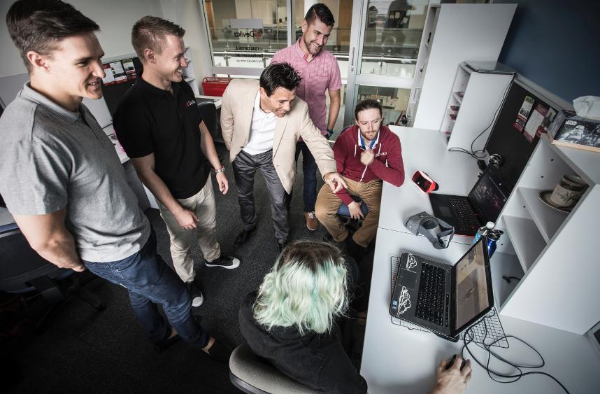
Smart Digital Twin Building is a result of a collaboration between the SMART Infrastructure Facility, Nube iO and Devika.
This application through smart sensing and 3D modelling allows for variables such as temperature and motion to be viewed in real time through a 3D virtual model of the SMART Infrastructure Building utilising IoT technology. This sensing technology is available to a wide range of possible clients looking to monitor and evaluate variables within any given structure.
Nube iO has installed 120 Nube iO smart sensors, one in each room or laboratory in the SMART Infrastructure Facility which monitor in real time, temperature, humidity, light and motion. Nube IO specialise in smart technologies and software aimed at monitoring indoor environmental conditions and optimising energy usage.
Devika, who specialise in virtual and augmented reality creations with a special focus on educational applications has developed a 3D model allowing users to interact and explore the virtual environment and view the results from the smart sensors and their actual data in real time.
Brief
In emergency situations, fast response times and adequate emergency facilities are critical in minimizing injury and death, as well as damage to property.
Complex site layouts, unknown environments and transient emergency response teams can magnify the difficulty of effective emergency response.
The Smart and Safe Campus aims to provide the campus with the latest internet-enabled technology to provide relevant information on safety equipment and safety hazards.
The app will be used by emergency services, insurance companies, and OH&S to locate items such as fire hydrants, first aid kits, defibrillators, gas and chemical storage facilities, toxic storage and flammables.
Project partner Safety Compass provide proprietary technology, which includes a mobile application, with the ability to dynamically spot site hazards and safety equipment
The project will integrate Internet of Things beacons to provide crucial information such as geo-location, maintenance information and types of toxic products and flammable materials.
Augmented Reality technology will provide emergency crews and first responders with crucial information as soon as they arrive at the site of an intervention.
The campus will be a demonstration site for emergency services and other organisations to experience the benefits of the Internet of Things. The offering will be progressively be made available across the nation.
Project Link
Project Contacts
Professor Marc in het Panhuis - UOW, Project leader, Materials and Surfing Trials
Professor Julie Steele - UOW, Biomechanics and Ethics
Associate Professor Buyung Kosasih - UOW, Computational Fluid Dynamics
Dr Andrew Warren - UOW, Economic Geography
Dr Stephen Beirne - UOW, 3D Printing
Mr Grant Barnsley - UOW, Computer Aided Design and 3D printing
Dr Alhoush Elshahomi - UOW, Computational Fluid Dynamics
Mr James Forsyth - UOW, Ethics
Matthew Berryman - SMART Senior Honorary Fellow and CEO Across the Cloud
Benoit Passot - SMART IoT Initiatives Coordinator
Project Sponsors

Brief
When a fire truck is responding to a fire call, seconds count. Details about the incident are sometimes incomplete – they may just be ‘fire at’ and the address.
When arriving on the scene, firefighters will be looking out for the closest hydrant to the fire. Because hydrants are often widely spaced out,the closest one is often not found and extra lengths of hose will be needed – and more time will be wasted.
Hydrants should be identified by blue cats-eyes on the road, but these are sometimes missing. The hydrant may also be buried or concealed by vegetation.
The Smart Hydrants app allows the firefighters to type in the address of the incident while on the way to a fire, then it will show them the location of the truck, the incident and nearest hydrants on a map
This allows the truck to be parked in the best position for the incident, saving precious seconds. If a second hydrant is required because the first is damaged, or the fire is large, another can be easily found.
The data so far loaded is suitable for the cellular network, though additional applications would use sensors and the LoRaWAN network.
The Smart Hydrants app received the IoT Award for Service Innovation at the Service Science Society of Australia awards.
Brief
The Smarter Schools for a Smarter Planet project, is aimed at enabling high school students, within the region, studying science, technology, engineering and mathematics to gain skills in the construction and use of smart technologies to monitor water issues relevant to their school environment.
This project started with the concept that if we want to make smart cities, we have to have smart people, so we wanted to train the trainer, and targeted potential future researchers. We started with engaging with high school teachers, introducing them to the power of the Internet-of-Things (IoT), and then engaging directly with students across the region.
UOW researchers engaged with ten high schools in the Illawarra-Shoalhaven, travelling as far as Ulladulla, and conducted workshops to explain IoT to the students and to demonstrate how students can start building sensors and their use in real-world applications. The workshops also introduced the concepts of open data and open software to the students. Each student was given an IoT development kit during the workshop.
The aim was to provide local high school students with the opportunity to look at ways in which smart technology can help manage the risk that flash flooding provides to residents. Students studying STEM (science, technology, engineering and mathematics) were provided with a real-life, hands-on chance to apply smart technology. We hoped to fire their imagination to encourage them to share their discoveries with their fellow students and the broader community.
The project also aimed at helping the high school teachers to develop their own IoT sessions through dedicated workshops, deepening their knowledge, skills and ability to engage students directly. The project team then provided both the necessary equipment and technical support to the teachers and their schools.
Aligning with Goal 3.2 of the 2020 - 2025 Strategic Plan, the UOW Smarter Schools for a Smarter Planet program, aims to share ideas, research, skills and expertise with our partners and communities.
The UOW Smarter Schools for a Smarter Planet program also aligns with the UN Sustainable Development Goals (UOW is a member of the UN Sustainable Development Solutions Network), specifically Goal 4 Quality Education, Goal 9 Innovation & Infrastructure and Goal 11 Sustainable Cities and Communities.
This project received funding from the Australian Government under the Smart Cities and Suburbs Program.
Project Contacts
Project Impact
Let’s build a network of sensors monitoring environmental conditions
Illawarra high school students are getting the opportunity to understand science
Smart cities need smart people
Brief
Over the past 50 years the Illawarra Shoalhaven has had more than 30 serious floods and three extreme floods. Floods can have devastating consequences and can affect the economy, environment and the people of our region. The Illawarra Shoalhaven region has been successful in being awarded $478,449 from the Australian Government, through its Smart Cities and Suburbs program to conduct its Smart Waterways project. This project is a collaboration between Wollongong City Council, Shellharbour City Council, Kiama Municipal Council, Shoalhaven City Council, Lendlease Calderwood Valley Communities and SMART Infrastructure Facility, University of Wollongong. Using smart technology via the installation of sensors, data will be gathered to monitor and provide information about the region’s waterways.
The project is delivered through seven components.
1. Stop Block - Stormwater Culvert Blockage Management
2. Flood Aware - Flash Flood Warning System
3. Go Flow - Smart intermittently closed lakes and lagoons (ICOLLS) Management
4. Quality Watch - Stormwater Quality Management
5. Pollution Stop - Gross Pollutant Trap (GPT) Management
6. Smarter Schools for a Smarter Planet
7. Extension of the regional LoRaWAN network with 4 additional Gateways
The Smart Water project is an excellent example of what can be achieved by SMART working with the highly motivated and creative staff in our local councils. SMART is contributing across all components. Water level sensors are deployed at key locations to provide live data on water levels and support the flash flood warning system component of the project.
Project Contacts
Project Impact
Let’s build a network of sensors monitoring environmental conditions


