

Black Summer’s trail of destruction put bushfire zones to the test
New research maps the lessons learned from devastating disaster
October 19, 2026
UOW research confirms NSW’s 100-metre bushfire buffer is broadly reliable but warns extreme weather could upend what we know about bushfire behaviour
When a ferocious fire is bearing down on a small community, how far from the bush is far enough for residents to feel safe? To what extent can we rely on the tools designed to protect our homes and families?
Associate Professor Owen Price, Director of the University of Wollongong’s (UOW) Centre for Environmental Risk Management of Bushfire, together with co-author Professor David Bowman from the University of Tasmania, set out to answer these questions, with the aim of understanding how we can mitigate our risks as Australia’s fire season becomes more extreme.
In the first large-scale study of its kind, published in the International Journal of Wildland Fire, the researchers overlaid more than 8500 buildings completely destroyed during the 2019-2020 Black Summer bushfires and onto the NSW Rural Fire Service's official bushfire risk prone zones.
“The Black Summer bushfires affected communities right across the state," Associate Professor Price said.
"The geographic and economic loss was enormous. The scale of the disaster gave us a way to test whether the 100-metre zone is still fit for purpose and whether the NSW Government’s bushfire mapping matches what actually happened to homes.
“This will help us to keep communities safer as bushfire seasons, both in Australia and around the world, become more intense.”
A critical tool for communities
Associate Professor Price and Professor Bowman studied the land burned by bushfires in NSW during the 2019-2020 disaster, an area that encompasses more than 5.5 million hectares, or 7 per cent of the state’s total landscape. The scale of the destruction was unprecedented.
Much of the destruction was centred on the South Coast and regional NSW, impacting communities that range from scattered settlements to suburbs around regional centres. Larger cities were unscathed.
In NSW, rural and urban areas within 100 metres of flammable vegetation are considered bushfire prone, with the risk diminishing the further the building is away from the bush. However, it is worth noting that areas outside of this zone can still be affected by a bushfire.
The research found the buildings that were lost were overwhelmingly those close to bushland, with 94 per cent within 100 metres of flammable vegetation, matching the buffer distance NSW already uses to identify homes at greatest risk. The study also found that 81 per cent of losses were inside areas designated as bushfire prone land.
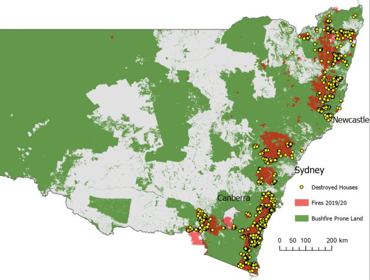
Map of New South Wales showing Bush Fire Prone Land with the footprint of the 2019–20 bushfires overlaid. The locations of the 2475 destroyed houses is indicated.
Most of the buildings lost beyond 100 metres were still within 200 metres of flammable vegetation. They were largely destroyed by embers, which either blew in from nearby fires or travelled from one burning house to the next.
"The 100-metre buffer holds up well for most conditions, and confirms that the official bushfire prone tool map is a reliable tool for communities, but our results suggest it may need another look in future," Associate Professor Price said. "As extreme fire weather becomes more frequent, there are grounds for revisiting that distance in risk mapping, and for focusing intensive fuel management on the edges of flammable bushland."
But these figures, while reassuring, do not tell the whole story. In times of extreme weather, Associate Professor Price found, the risk of buildings sustaining damage outside that zone increases.
Using hourly observations from the Bureau of Meteorology, as well as 17 portable weather stations that were used by the Rural Fire Service in fire zones, the researchers untangled the connection between the fire and the weather conditions.
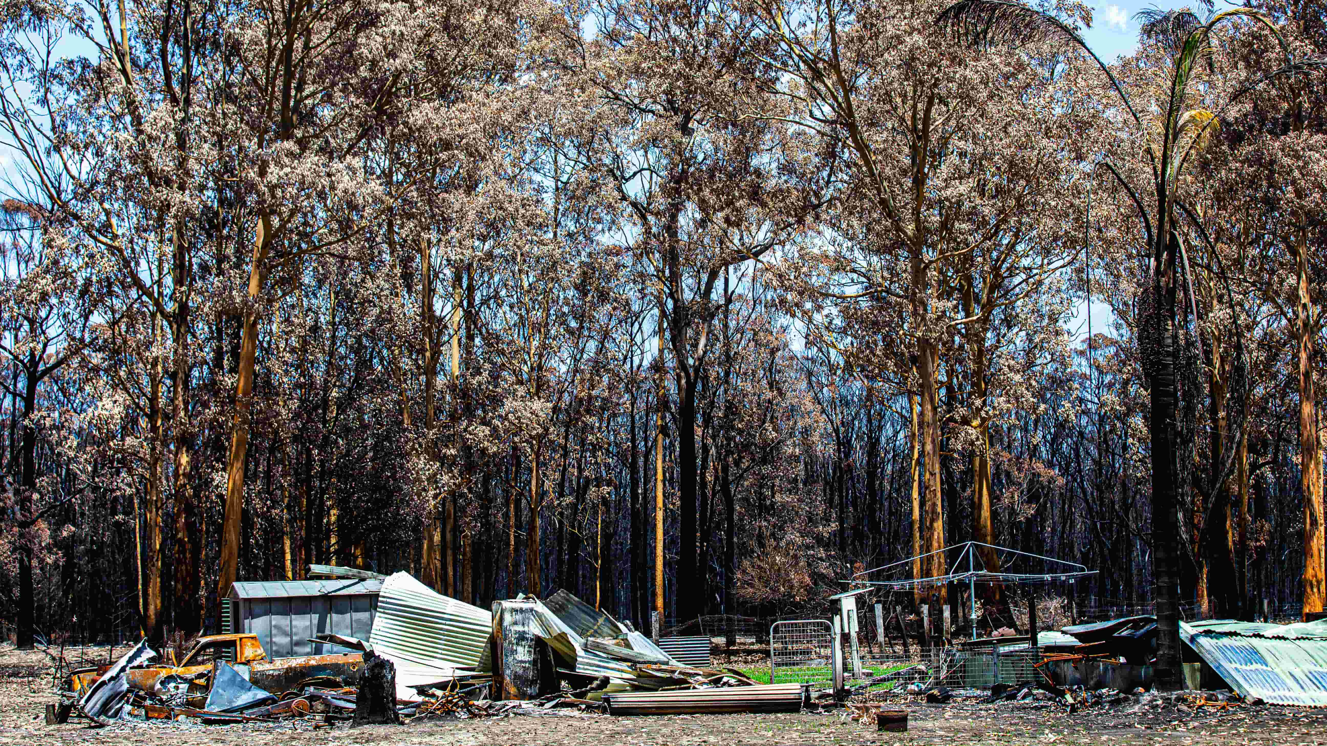
The Black Summer bushfires, which occurred on the back of severe drought and soaring temperatures, were so intense and volatile that sparked an extraordinary number of pyrocumulonimbus fires.
"One of our key findings was that under extreme fire weather, houses were lost further from flammable vegetation," Associate Professor Price said. "It is reasonable to expect climate-driven bushfires to destroy more buildings in these areas in the near future.
“Any changes to current policy and practice would have major social, economic and environmental consequences, so they need careful thought as we navigate an unprecedented fire environment.”
Not all bush burns the same
For the first time, the research also considered how the type of vegetation that surrounds an area affects its bushfire risk.
While eucalypt trees, of which there are more than 700 different species in Australia, are native to the landscape they also pose a significant risk to people and property.
Eucalypt forests are among the most fire-prone landscapes in Australia. Eucalypt leaves contain volatile oils that burn readily while the trees continually drop leaves, bark and twigs that build up as dry littler on the forest floor. Eucalypts are well adapted to fire, with many species able to regrow from buds protected beneath the bark or from the base of the tree after being burnt.
Houses located next to eucalypt forest were about five times more likely to be destroyed than houses located next to other types of flammable vegetations, such as grassland and rainforest. Nearly 75 per cent of homes lost during the Black Summer bushfires were close to eucalyptus forest.
Other types of flammable vegetation behave differently. By comparison, rainforest is typically moist and shaded, with plants that burn far less easily. It is usually too damp to ignite easily. Grassland can burn quickly but generally produces lower intensity fires and fewer embers.
"We've known for some time that being close to eucalypt forest increases the risk to a home," Associate Professor Price said.
"What we hadn't done before was directly test how different types of vegetation compare. Our results show that eucalypt forest stands out.
"That's a clear signal about where the risk is greatest, and it can help communities and planners decide where to focus their preparation."
How urban sprawl increases fire risk
The struggle between urbanity and the environment is at the heart of the global conversation around the impact of bushfires.
We accept fire as part of the Australian landscape, and indeed, many who live in regional and rural areas grow up with memories of a summer tainted by the acrid stench of smoke and the glow of an orange sky, yet we are not the only nation that faces the menace of fire.
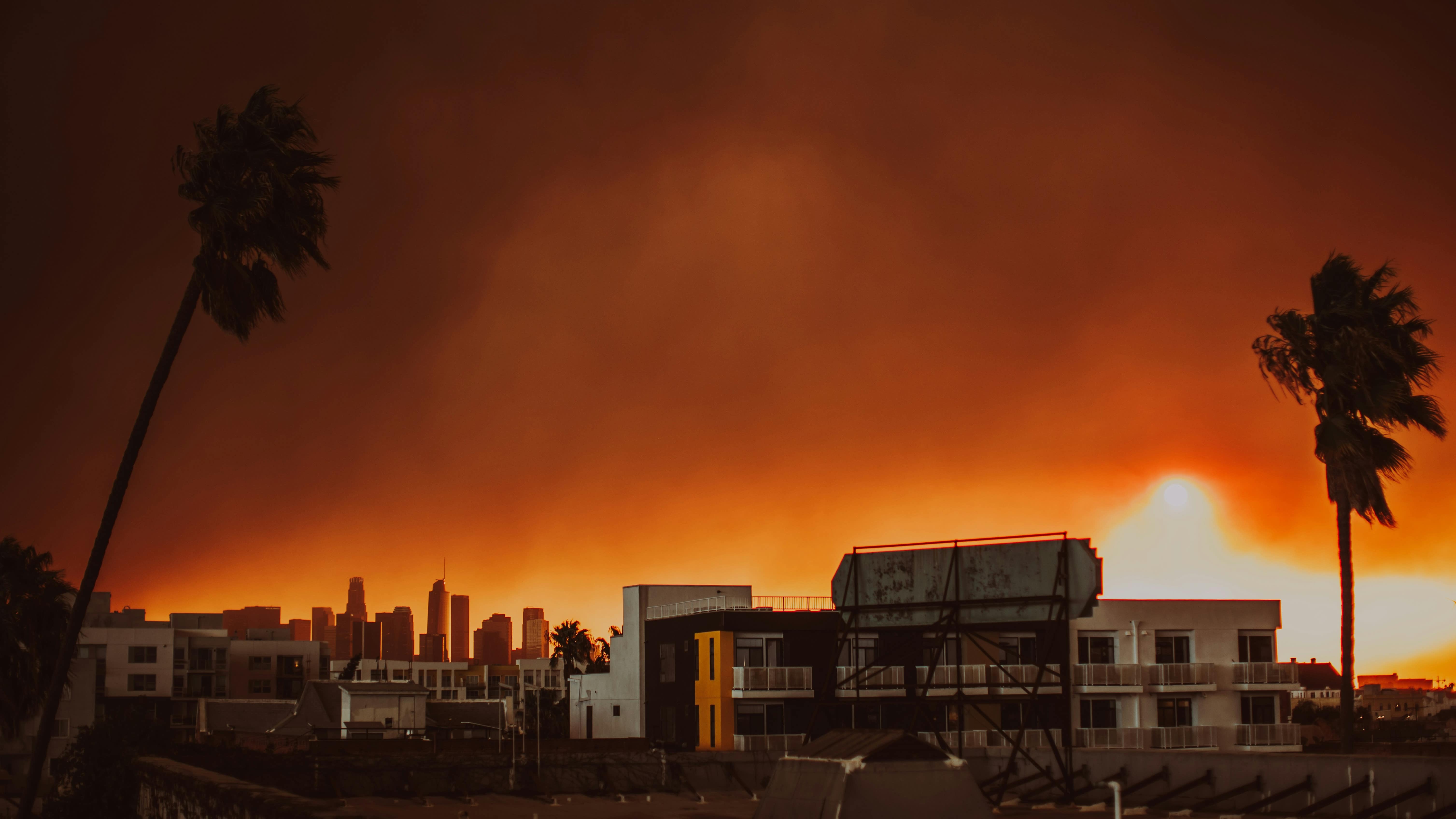
Associate Professor Price points to growing examples of cities around the world grappling with fire impinging on urban areas, most recently and devastatingly in Los Angeles in 2025, but also in other parts of California, Hawaii, and in Chile. Canada, a nation known for its verdant landscape, was decimated by unprecedented fires last year, while countries throughout Europe have been engulfed by huge wildfires.
In each of these cases, the fires reached areas that were considered low risks, so the buildings weren’t designed to withstand fire.
Globally, this combination of sustained urban expansion into uncultivated land, turbocharged by climate change, has resulted in more houses, and lives being lost, and damage estimates that reach into the billions.
“Around the world, cities and suburbs are expanding into natural environments, such as bushland and forests, at the same as the climate is making fires more dangerous and intense.
"Between 1992 and 2015, an average of 2.5 million homes were in the path of a fire, a number that is only set to increase,” Associate Professor Price said.
“Australia is part of that bigger picture, so reducing the risk in areas where homes bump up against the bush is a major concern for communities, emergency services, and governments.”
As climate change intensifies bushfire behaviour, and lengthens the bushfire season, Associate Professor Price warned tools that are currently fit for purpose might not always withstand extreme conditions.
“This type of urban firestorm has not really occurred in Australia, but that does not mean it never will. Climate change is bringing more frequent and severe fire weather, and the areas where homes meet the bush are expected to grow. The overseas disasters are a harbinger of what could happen in Australia,” he said.
"Fire has always been part of the Australian landscape, but our understanding of what fires can do is changing and our planning needs to keep pace. That means good evidence, sound planning, and communities that have the knowledge and support to properly prepare. Research like this helps us build those foundations for the future.”
About the research
‘House loss patterns in the Australian 2019–20 fire disaster confirm the reliability of official risk mapping’, by Owen Price and David Bowman, was published in International Journal of Wildland Fire.
The research was funded by Natural Hazards Research Australia.